 |
|
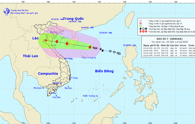
Moving direction of Typhoon Nangka (Source: nchmf.gov.vn) |
By 4am on October 13, Nangka was about 170km north-northwest of Vietnam’s Hoang Sa (Paracel) archipelago, boasting strongest winds of 90km per hour.
The danger zone in the East Sea will see winds of Scale 6 or above, with gusts at Scale 8 or even higher. All vessels operating in this area are at risk of being seriously affected by strong gusts.
In the following 24 hours, the storm will keep moving west-northwest at a speed of 15-20kpm. It is forecast to make a landfall on October 16 in northern and northern central localities before weakening to a low pressure.
In the morning of October 13, heavy rains hit central localities with popular rainfall of 50mm. Rains will reduce in the afternoon of the same day.
From October 14-16, northern and north-central localities will be affected by torrential rains.
Experts advised owners to carefully dock the boats to avoid damage due to the extremely strong wind.
They forecast that widespread flooding will continue in central provinces from Quang Binh to Quang Nam, with high risks of landslides. Locals in risky areas are advised to move to safer places./.VNA